
About Faunero

Why I built it, and the rules it follows around wildlife.
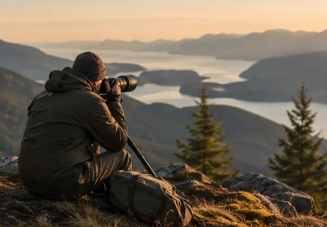
A wildlife photographer at a misty overlook, scanning a valley below.

Building Faunero

Your Journal is a private place to remember what you saw. Save a few words, a photo or a voice clip, even offline, and add details later. Look back at your entries, then plan the next trip from what caught your eye. Photos and clips stay on the phone where you saved them and are not yet backed up.

Thank you for taking the time to explore and learn about Faunero. I am a photographer and the solo developer of this tool. It started as an experiment to build the kind of tool I wanted to plan my own trips. It has transformed into a tool I hope many people will enjoy and find useful.

I've always used multiple tools to research and plan trips, multiple browser tabs, a few different apps, and that won't completely change as one app just can’t do everything well. Some tools that do one good thing are better than tools that try to do it all, but I wanted a tool that can both get me started and be a place for me to put everything together in a structured plan that I can take with me and access online or offline.

The result is "Faunero": wildlife trip planning for birders, photographers, and nature travelers. It is built for people who want to understand a place before they arrive, make better choices in the field, and respect ethical boundaries.

Wildlife ethics

Everything here is built around a single principle: the welfare of the animal comes before seeing the animal or taking the photo. In practice that means a few concrete things, not slogans.

  • Faunero doesn't surface precise coordinates for vulnerable wildlife — nests, dens, roosts. The guidance points you to access points and general areas, never an exact pin on a breeding raptor or a denning predator.

  • No sighting leaderboards. No rare-species gamification.

    Faunero isn’t a social hub. There is no "life list" race, no streaks, no "first in your region" badges, no public ranking of users by rarity. Every sighting app that adds this feature ends up with the same problem — coordinated harassment of rare birds and mammals by people chasing a number. I'm not building that engine.

  • Safety over social broadcasting

    Nothing broadcasts your location to other users — there is no public map and no real-time location sharing.

What this will never be

The shape of an app is as much about what it doesn't do. These are the features you will never find here, and I'd rather lose a user to a competitor than add them.

  • I will never sell observation data.

    Your pins, your trips, your Journal — none of it goes to data brokers, ad networks, or training data licensees. Premium revenue exists so this one doesn't have to.

  • I will never leaderboard rare species.

    No "top 10 sightings this month", no "rarest bird spotted", no "users who saw the most endangered species". The consequences of those features to the animals are documented and I'm not going to relearn them.

  • I will never use dark patterns to re-engage you.

    No streak-shaming push notifications. No "you haven't opened the app in 3 days" guilt. No notification spam. You come back because Faunero is useful, not because you're being emotionally managed.

  • I will never hide the data sources.

    Visit — see /attribution for a full list of the data sources I use to provide reliable and grounded sources.

Where we are, where we're going

Faunero is in its early life. The future will bring refinements and updates that will align with the ethical treatment of wildlife and nature. I am very open to suggestions and requests for features or modification of existing features. Please send me your thoughts!

Contact

This is a one-person operation, so response times are human-scale. Use Feedback in the menu to send me a message. For everything else, my email is below.

[email protected]

Give back

Faunero exists because wildlife travel is only worth doing if the wildlife is still here. These are organizations I personally support. Each is independent, accepts direct donations, and works on the problems this app quietly depends on. Faunero gets nothing for sending you to them. Pick one and send them ten bucks.

Suggestions only. Research any org before you give — Charity Navigator and ProPublica's Nonprofit Explorer both publish their financials. If you'd like an organization added or removed, email me.

Where the data comes from

Faunero doesn't generate its own biodiversity or weather data. It composes public and licensed sources, and the honest way to build trust with you is to name all of them.

For the canonical list — with every required attribution string, license URL, and the M5 protected-area catalogs (PAD-US, CAPAD, Natura 2000, Wikidata) — see /attribution.

A moment, saved

Example: a quick entry with no signal.

  1. 1. Type

    Two herons by the pond

  2. 2. Tap Save

    Save
  3. 3. Saved offline

    Waiting to sync

Add a photo or voice clip now. Fill in the rest later. Photos and clips stay on this phone and are not yet backed up.

Start with whatever you know

Faunero meets you at whatever you actually know — a region and some dates, a species on your list, an itinerary pasted from your notes — and works forward from there.

A destination or region
A species you want to see
An itinerary you can paste
A date already on the calendar

60,000+ wildlife locations

Refuges, wetlands, reserves, river accesses, trailheads — researched, tied to a source you can check. Where the evidence is thin, Faunero says so instead of guessing. More regions are frequently added, and you can suggest new areas that Faunero doesn't know yet.

Never

Shows exact nest or den spots

Every one

Cited to a checkable source

Reviewed

By a person, before it appears

Malheur National Wildlife Refuge

Wildlife area · Oregon · United States

43.2658, -118.8442

Doñana

Wildlife area · Andalusia · Spain

36.9652, -6.4309

Parque Estadual do Pantanal do Rio Negro

State park · Mato Grosso do Sul · Brazil

-19.4263, -56.6055

Know a place that belongs here? Send it in through in-app feedback. Every suggestion is researched and reviewed by a person before it joins the map.

Itinerary · Day 2

Steens loop

Version 14
06:10

Malheur NWR — headquarters ponds

First light · snow goose staging

09:40

Buena Vista overlook

Raptors on the thermals

16:30

Krumbo Reservoir road

Evening loop before sunset

Drive 1h 50mSunset 20:42

Plan check: the refuge visitor gate opens at 07:00 — a 06:10 start only works from the outer road. Suggested: swap the first two stops.

AcceptDismissNothing changes until you say so
Recreated from an itinerary. It uses a real catalog place and a worked scheduling example.

A plan that changes with your trip

Group real places into days with drive times and daylight. When weather turns, a road closes, or last night’s sighting changes your priorities, the plan can recalibrate around what still matters — and every change lands as a proposal you accept or reject. Nothing rewrites your trip behind your back.

Edit it on your phone in the field and it’s the same plan back at the desk. If two edits clash, Faunero asks you which one to keep. Build every day yourself, or let Faunero draft an itinerary from verified places and approve the parts you like.

AI you can turn on or off

Every intelligent feature sits behind its own switch. Planning help starts on for Premium and off for Free. On Premium, remembering your travel preferences and reading your journal notes also start on. Proactive plan checks wait until you turn them on. You can turn any of it off at any time.

When it’s on, answers are grounded in the catalog’s cited evidence, and Faunero will learn your travel preferences and journal notes. When it’s off, everything still works: rankings, the pulse, and the daylight math are worked out by the app and never use AI.

Faunero Intelligence

Master switch for everything below

Plan Talk

A planning conversation that proposes — never applies.

Proactive plan review

Flags conflicts like gate hours and daylight before you hit them.

Capture

Voice-note transcription and trip recaps from your own notes.

Place

Deeper context on the places you're actually considering.

Trip

Recall from your past trips while you plan the next one.

A working copy of the real switches in Settings. In the app, the master switch starts on for Premium and off for Free. You can turn any of them off.

On this day

2 years ago
First light at the headquarters ponds — two hundred snow geese lifted at once and the sound got there before the light did. Frost on the boardwalk. Next time: arrive twenty minutes earlier and bring the longer lens.
Malheur NWR · OregonDictated in the field
A sample note, kept the way your Journal keeps them — attached to a real place and a real date, resurfacing when they matter.

Memory you can search

Log what you saw — dictated in the field or typed at the desk. Journal entries attach to real places and dates, so history compounds: “on this day” recall while you plan, visit history on every place card, and trip recaps when you’re home.

If you allow it, the Traveler Profile remembers only what you’ve explicitly told it — and you can read and edit every line it holds. Your memory stays owner-private, inspectable, and exportable. No community feeds, ever.

Your itinerary works without signal

Your whole trip — the day-by-day plan, place and species notes, light windows, and a per-country safety card — cached to your phone and readable with no bars at all. Edit it out there and it re-saves, exactly once, when you’re back in range. This panel is the app’s real low-light field mode.

Day-by-day plan with map snapshots
Focus species and field timing
Sun, moon, and light windows
Per-country safety card
Offline notes with visible sync and conflict status
Print your trip for the glovebox

Planning help you can check

Source labels, confidence notes and clear ethics limits sit right beside each suggestion. A spot with more sightings may just have more birders, and every screen shows its sources and how fresh they are.

Faunero does not generate precise animal locations.

Faunero points you to access points and general areas, not exact nests, dens, roosts, or individual animals. When a trusted source obscures coordinates, Faunero keeps that source-provided obscuration.

Owner-private by default; nothing you save is ever public unless you publish it. No community feeds, ever.

More things it does

Near-home pulse

A quiet dashboard card: recent sightings within a set distance of home, with the coverage radius spelled out. Worked out by the app, without AI.

Light windows

Sunrise, sunset, and golden hour for the places you're planning around — because in wildlife travel, when matters as much as where.

Exports that travel

GPX and KML for your GPS, a calendar file for the trip dates, print for paper. Your plan is yours to take anywhere.

Compare places

Line candidate stops up side by side — evidence, timing, access, drive — before you commit a day to one of them.

Ethics built in

Exact nests, dens, and roosts never appear. When a trusted source obscures coordinates, Faunero keeps that obscuration. The rule is built into the code.

Sample travel plan

Vegas conference birding window

A travel-first plan that protects the work trip, uses early and late light, keeps drive time honest, and gives backup stops when wind or heat makes the desert difficult.

Starter question

I am in Las Vegas Apr 19-24 for a conference. I have two evenings and one free day. What birds or wildlife are worth planning around within a 2-3 hour drive?

Itinerary preview

Compare constraints, then save the useful stops.

Start a similar plan
1Las Vegas Valley

Henderson Bird Viewing Preserve

Wetland habitat close to the conference base makes it the safest evening or short-morning option when the work schedule moves.

Drive
22-35 min
Best
6:10-8:30 AM or last hour
Likely

spring migrants, waterfowl, shorebirds

Ethics

Stay on paths and avoid pushing birds around pond edges for a cleaner angle.

Field memory

Mark which ponds held activity and whether afternoon heat shimmer spoiled long shots.

Source: GBIF occurrence records + public access notesConfidence: High for access, medium for target mix
2Mojave Desert north of Las Vegas

Corn Creek, Desert National Wildlife Refuge

Spring movement, water, shade, and habitat contrast make this a strong one-morning extension without consuming the full day.

Drive
45-65 min
Best
sunrise to 9:00 AM
Likely

desert birds, quail, possible bighorn sign

Ethics

Use quiet approach near water and give wildlife a clean path to drink.

Field memory

Record shade, water level, wind, and whether the visitor area stayed productive after sunrise.

Source: Refuge/access data + GBIF occurrence recordsConfidence: Medium-high for birds, variable for mammals
3Amargosa Valley

Ash Meadows National Wildlife Refuge

This is the highest-value full-day option: unusual habitat, boardwalk access, and a real sense of place for a traveling birder-photographer.

Drive
1 hr 45 min-2 hr 10 min
Best
full free day, dawn departure
Likely

desert specialists, water birds, endemic habitat

Ethics

Boardwalks and closures are part of the habitat protection system, not suggestions.

Field memory

Log boardwalk orientation, closed areas, best light direction, and whether the drive felt worth repeating.

Source: Refuge/access data + GBIF occurrence recordsConfidence: High for place value, medium for specific species

Plan your next trip

Start with a destination, a species, or a date already on the calendar. Build every day yourself, or have it drafted and approve what you like — AI off, on, or in between.

Start planning